
Hiking Trails at Smith Rock State Park
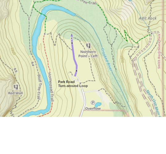
Monument Overlook Trail
0.30 mile there-and-back, with 8 feet elevation gain. Gravel trail. Popular with Golden Eagle watchers, look across at the 600 foot Monument towers and try to find the 12 foot tall eagle nests on the cliff face. Park at the very end of the road, at the turnaround loop.
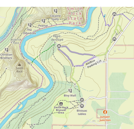
Main Area Overlook Trail
.42 mile loop, with 10 feet elevation gain. Gravel trail. Offers a panoramic view of Smith Rock's famous "Main Area". A nice place to sit and watch the climbers across the canyon. Park in the RV/Bus parking area.
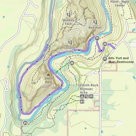
River Trail Monkey Face View
4.0 miles out-and-back, with 460 feet elevation gain. Gravel trail drops down into the canyon, then follow the easier River Trail left to a classic view of Monkey Face rock. From the turnaround spot shown on this map, you can really see why it's called Monkey Face! Note: the turnaround point shown here is not signed, just turnaround once you get the view of the Monkey. Park near the main restrooms and information yurt.
Misery Ridge Trail
1.92 miles out-and-back, with 805 feet elevation gain. Gravel trail switch-backing up and down a steep hillside. The most popular variation of this trail is shown here, ending at an up-close view of Monkey Face rock (and it's climbers) and then reversing course. From up there you can see all of central Oregon. Park near the main restrooms and information yurt.
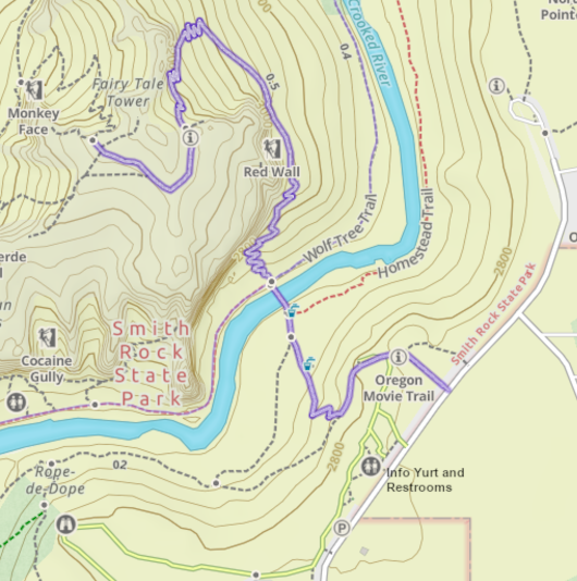
Misery Ridge Loop Trail
3.6 mile loop, with 910 feet elevation gain. Gravel trail switch-backing up and down a steep hillside, then following the River Trail back home. Gives you a bird's eye view of central Oregon from the Monkey Face overlook, then head down to the Crooked River for a more restful walk before hiking back out of the canyon. Park near the main restrooms and information yurt.
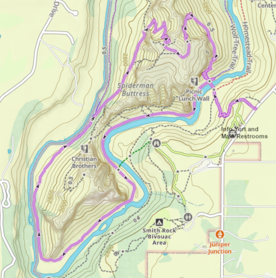
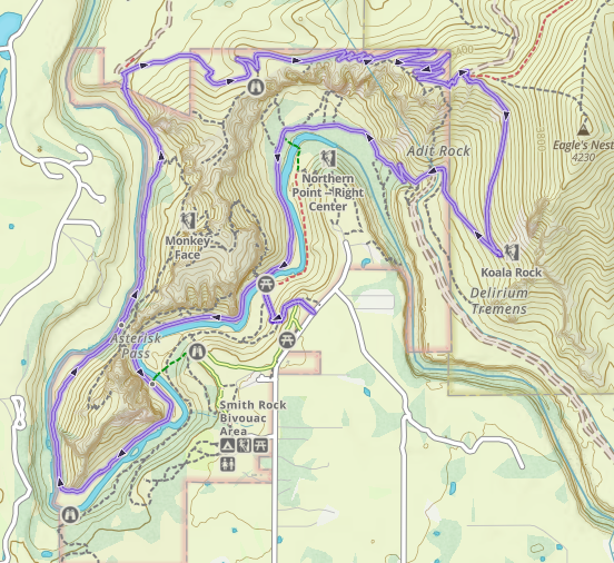
Summit Loop Trail
7 miles, with 1,200 feet elevation gain. Gravel and dirt trail. A great overview of the Smith Rock area. After hiking down into the canyon, follow the river trail past the classic view of Monkey Face, then branch leftward for a long climb up to the highest viewpoint of the park. From there, follow the gravel Burma Road back down into the main part of Smith Rock State Park, and follow the Crooked River up-river to the footbridge and back up to the starting point. Park near the main restrooms and information yurt. Note: If you have a dog, be extra careful when you get near the irrigation canal tunnel at the bottom of the Burma Road; just below where it says "Adit Rock" on the map. A few unlucky dogs have been swept through this mile long tunnel.